
- Home
- Getting Started
- Documentation
- Release Notes
- Tour the Interface
- Tour the Layers
- JMARS Video Tutorials
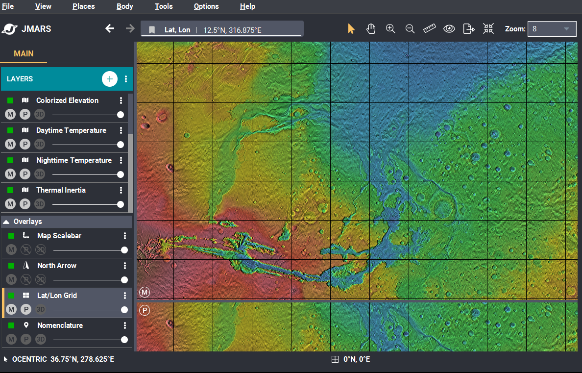
- Lat/Lon Grid Layer
- Map Scalebar
- Nomenclature
- Crater Counting
- 3D
- Shape Layer
- Mosaics
- Map
- Advanced/Custom Maps
- Graphic/Numeric Maps
- Custom Map Sharing
- Stamp
- THEMIS
- MOC
- Viking
- CRISM Stamp Layer
- CTX
- HiRise
- HiRISE Anaglyph
- HiRISE DTM
- HRSC
- OMEGA
- Region of Interest
- TES
- THEMIS Planning
- Investigate Layer
- Landing Site Layer
- Tutorials
- Video Tutorials
- Displaying the Main View in 3D
- Finding THEMIS Observation Opportunities
- Submitting a THEMIS Region of Interest
- Loading a Custom Map
- Viewing TES Data in JMARS
- Using the Shape Layer
- Shape Layer: Intersect, Merge, and Subtract polygons from each other
- Shape Layer: Ellipse Drawing
- Shape Layer: Selecting a non-default column for circle-radius
- Shape Layer: Selecting a non-default column for fill-color
- Shape Layer: Add a Map Sampling Column
- Shape Layer: Adding a new color column based on the values of a radius column
- Shape Layer: Using Expressions
- Using JMARS for MSIP
- Introduction to SHARAD Radargrams
- Creating Numeric Maps
- Proxy/Firewall
- JMARS Shortcut Keys
- JMARS Data Submission
- FAQ
- Open Source
- References
- Social Media
- Podcasts/Demos
- Download JMARS
Lat/Lon Grid Layer
The Latitude/Longitude Grid Layer, which is available in all releases of JMARS, draws latitude and longitude lines in the Viewing Window and allows users to measure distances.
Display a Latitude/Longitude Grid
-
Open the Lat/Lon Grid Layer: The Lat/Lon Grid is a default layer in JMARS that will open
automatically whenever JMARS is started.
- If you need to re-open the Lat/Lon Grid Layer after closing it, go to the Layer Manager, choose "Add New Layer" -> "Lat/Lon Grid"
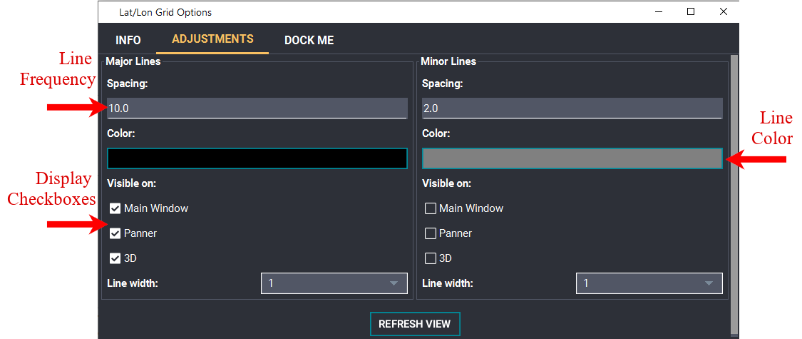
- Edit the Default Grid Settings: To change any of the layer's default settings (ie: line spacing, line color, etc), double click on the "Lat/Lon Grid" tab in the Layer Manager to access the focus panel.
- Select Major Line Frequency: JMARS defaults to placing major latitude and longitude lines at 10 degree intervals, but this can be changed by editing the "Major Lines" box. Users can also chose whether or not the major lines are displayed in the Main and Panning Views by clicking the appropriate checkboxes.
- Select Major Line Color: The default color for the major lines is black, but it can be changed by clicking on the black color box and choosing a new color.
- Select Minor Line Frequency: JMARS defaults to placing minor latitude and longitude lines every 2 degrees, although it does not automatically display them in either the Main or Planning Views. Users can add the minor lines to either view by clicking on the appropriate display checkbox. Any number that divides evenly into 90 degrees can be used for the minor line frequency. Some examples are 0.5, 2, 5, 15,45 degrees.
- Select Minor Line Color: The default color for the minor lines is gray, but it can be changed by clicking on the gray color box and choosing a new color.

Related Pages
- Tutorial #1: Viewing THEMIS VIS Coverage
- Tutorial #2: Displaying the Main View in 3D
- Tutorial #3: Finding THEMIS Observation Opportunities